Mount Sarakura 皿倉山 2019.2.27
Mount Sarakura is a famous mountain that overlooks Kitakyushu city and sea. There is a cable car station at the base that takes you directly to the summit but if you would prefer to trek the hike is a good one. I started my hike at JR Yahata station and walked directly to the cable car area. From there I went to the summit of Mt. Sarakura and then explored three other peaks one of which doesn't seem to appear on google maps but is well sign posted once you get to the top. On the way I I also stopped by the visitor centre which is right at the end of the hiking route. The staff there were very talkative and it is largely manned by mountain enthusiasts who are eager to talk about the mountain's history and nature.
Access: Head to JR Yahata Station 八幡駅. From there walk directly out of the station and keep going straight up the main wide road. Eventually you come to a split. Follow the signs to the right which head up to the cable car.
Gear: You don't need a hiking pole for this hike. Regular sports shoes would be ok however there are some rougher sections and one stream to go over/through so hiking boots maybe useful for that. There are vending machines at the top and a water spring on the way up so don't overpack liquids. The summit is windy so pack a windbreaker in the colder months.
Not far from the start I came to a small temple; Horinzen temple 法輪禅寺. It was a little poorly kept but obviously still being looked after perhaps by a larger temple near the mountains base.
I flirted with the idea of taking other paths down but without being 100% sure where they went to ultimately decided to return the route I came. But used the steps and a few other cut throughs to add variety. All in all it took about 3 hours with a lunch break. It could take longer to visit all of the peaks and there is an option to hike down the other side to a reservoir however the public transport from that side is poor.
The full photo album of the hike can be found here
Access: Head to JR Yahata Station 八幡駅. From there walk directly out of the station and keep going straight up the main wide road. Eventually you come to a split. Follow the signs to the right which head up to the cable car.
Gear: You don't need a hiking pole for this hike. Regular sports shoes would be ok however there are some rougher sections and one stream to go over/through so hiking boots maybe useful for that. There are vending machines at the top and a water spring on the way up so don't overpack liquids. The summit is windy so pack a windbreaker in the colder months.
|
|
After following the main road for some time I came to these steps which go directly toward to mountain and cut through the houses.
After going through the houses I came this bridge the trail head starts not far on the other side.
|
Walk a little way up the road and past the cable car station to find the trail start point pictured. There are a number of options to reach the top which are displayed on a circular map.
|
Not far from the start I came to a small temple; Horinzen temple 法輪禅寺. It was a little poorly kept but obviously still being looked after perhaps by a larger temple near the mountains base.
|
|
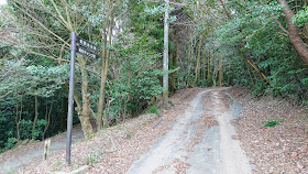
For the early part of the hike I followed the mountain road up, every so often intersecting it at points and then cutting through forest following the mountain signs. Eventually this ended and the main part of the hike began.
|
|
|
|
The last leg to the visitor centre and the top of the mountain. The steps and trail to the right of this is a slightly nicer way to go up.
|
|
|
There are toilets and vending machines here. The visitor centre is manned and the people there are friendly and love to talk about the mountain which is their passion.
|
|
|
The summit of Mt. Sarakura. There are lot of radio towers owned by various TV networks including the national NHK network. The views are expansive. The views are famously on of the "A million dollar nighttime views of Japan"
|
|
|
|
|
|
The cable car station. The easiest way up or down is worth a ride.
I left here and returned to the picnic area to head to two more peaks Mt. Gongen and another peak which doesn't appear on google maps so I am not sure what the translation should be.
|
The first mountain. Mt. Gongen 権現山 starts here. I cut through the camping entrance area (Closed in the winter) to cut the corner off and headed up towards Hobashiragongenyama Shrine 帆柱権現山神社
|
|
|
|
|
I took in the view ate some lunch and headed down to start the climb of the last mountain peak of the day. On the way there I walked through a beautiful forest with some really large and old trees.
|
The main tree of the forest area. But actually there were a lot of large trees in the area.
|
|
|
|
|
|
The path to the final peak was steep and had far less foot traffic than the main mountain. It doesn't seem to appear on google maps however it is well signposted.
|
The full photo album of the hike can be found here


